


Geography and climate
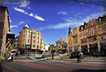
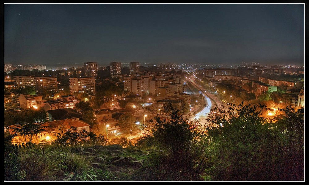
Plovdiv is located on the banks of the Maritsa river, approximately 152 km (94 mi) southeast of the Bulgarian capital Sofia. The city is situated in the southern part of the Plain of Plovdiv, an alluvial plain forming the western portion of the Upper Thracian Plain. The heights ofSredna Gora rise to the northwest, to the east are the Chirpan Heights and the Rhodope mountains surround the plain from the south. The city had originally developed to the south of Maritsa and it spawned across the river in the last 100 years. Modern Plovdiv covers an area of 101 km2 (39 sq mi), which is less than 0.1% of Bulgaria's total area. This makes the city is the most densely populated in the country with 3,769 inhabitants per km².
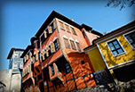
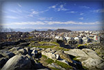
Inside the city proper are located six syenite hills, called tepeta. In the beginning of the 20th century there used to be seven of them, but one (Markovo tepe) was destroyed. Traditionally the citizens have called them Dzhendem tepe, Bunardzhik, Sahat tepe, Nebet tepe, Dzhambaz tepe and Taksim tepe. The last three form the area of the Three Hills (Bulgarian:Трихълмие), a lively section of the city centre.
Climate
The climate is temperate with influence from the Mediterranean Sea and is typical of southeastern Europe. Summers are generally extremely hot and dry. Winters are cold, with a slight Mediterranean influence, often they're very cold with a Continental character. The average annual temperature is 12.3 °C (54.1 °F). The average maximum temperature is in July - 30.3 °C (86.5 °F) and the absolute maximum was recorded during the same month in 2000 45 °C (113 °F). Weak winds (0–5 m/sec) are predominant in the city and the surrounding area. The average minimum temperature is 6.5 °C (43.7 °F) and the absolute minimum was −31.7 °C (−25 °F) measured during an inversion. The average relative humidity is 73%, it is highest in December - 86% and lowest in August - 62%. The total precipitation is 540 mm - the wettest months of the year are May and June with an average precipitation of 66.2 mm, while the driest is August with an average of 31 mm. The average number of days with a snow blanket in Plovdiv is 33. The average depth of the blanket of snow is 2 to 4 cm (1 to 2 in) and the maximum is normally 6 to 13 cm (2 to 5 in) but in some winters it can reach 70 cm (28 in) or more. Gentle winds (0 to 5 m/s) are predominant in the city with wind speeds of up to 1 m/s representing 95% of all winds during the year. Mists are common in the cooler months especially along the banks of the Maritsa. On average there are 33 days with mist during the year.
Climate table:
| [hide]Month | Jan | Feb | Mar | Apr | May | Jun | Jul | Aug | Sep | Oct | Nov | Dec | Year |
|---|---|---|---|---|---|---|---|---|---|---|---|---|---|
| Record high °C (°F) | 16 (61) |
23 (73) |
25 (77) |
31 (88) |
32 (90) |
36 (97) |
40 (104) |
38 (100) |
35 (95) |
33 (91) |
23 (73) |
19 (66) |
40 (104) |
| Average high °C (°F) | 5 (41) |
7 (45) |
12 (54) |
18 (64) |
23 (73) |
28 (82) |
31 (88) |
30 (86) |
26 (79) |
21 (70) |
12 (54) |
6 (43) |
20.6 (69) |
| Average low °C (°F) | -3 (27) |
-2 (28) |
1 (34) |
5 (41) |
10 (50) |
14 (57) |
16 (61) |
15 (59) |
11 (52) |
8 (46) |
3 (37) |
-2 (28) |
10.1 (50) |
| Record low °C (°F) | -23 (-9) |
-25 (-13) |
-18 (-0) |
-4 (25) |
0 (32) |
6 (43) |
8 (46) |
8 (46) |
0 (32) |
-3 (27) |
-8 (18) |
-17 (1) |
-25 (-13) |
| Precipitationmm (inches) | 39 (1.54) |
33 (1.3) |
37 (1.46) |
36 (1.42) |
51 (2.01) |
65 (2.56) |
37 (1.46) |
28 (1.1) |
32 (1.26) |
41 (1.61) |
49 (1.93) |
44 (1.73) |
462 (18.19) |
| Source: BBC Weather Centre 2013-03-07 | |||||||||||||